
Waterfalls & Ghost Towns: Eagle Falls Trail in Cumberland Falls State Park (Corbin, KY)
Since returning to Kentucky this past spring, I’ve been lucky to be able to hike regularly, spending my free day on the weekends in Red River Gorge or Berea. However, and I’m sure others can relate, there comes a point when you try to decide what trail to hike that weekend, and every suggestion is met with, “We just did that one.” Suffice it to say, last weekend, we were Gorge-ed out and in the mood to get away from Lexington to take the edge off our wanderlust. We settled on a day-trip to Cumberland Falls, a state park a little less than two hours away.
Cumberland Falls State Park, nestled in Daniel Boone National Forest, was created in 1931. For the 10,000 years prior, Indigenous peoples lived in the area, with Cherokee and Shawnee peoples making use of the rock shelters along the river and the Chickasaw and Creek nations using the area for temporary hunting camps. According to some accounts, the Indigenous name for Cumberland Falls was the “Great Falls,” with the Cumberland River Gorge area known as “The Land of the Hummingbird.” Both Cumberland Falls and another waterfall in the same park, Eagle Falls, are considered sacred to these Indigenous peoples. When Thomas Walker, an explorer from Virginia, rediscovered the falls in 1750, he renamed them to honor the Duke of Cumberland.
The park has many trails to hike, from easy half miles down to the falls viewing area (accessible by parking lot), to 10.8 miles through Sheltowee Trace and ending at the Laurel River. Since my brother and I hadn’t been to the park since we were young and wanted good views of the falls, we opted for the Eagle Falls trail, a fairly easy 1.5-mile trail that gives plenty of views of Cumberland Falls, takes you along the river and through lush forest, and ends in Eagle Falls.


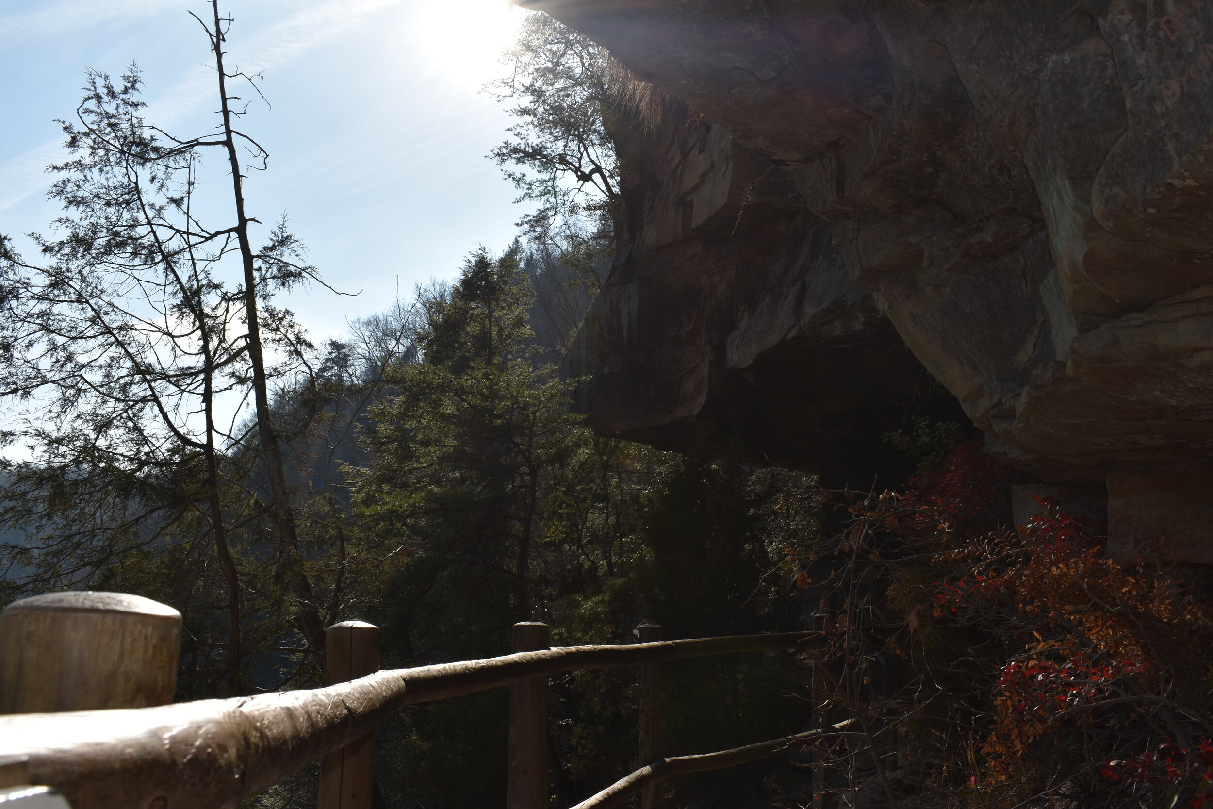
It was a beautiful low-50’s winter day, and the trail began with glimpses of the falls through the trees, the thunderous rush of water obscuring the sound of our voices. Not far into the trail, we saw a sign for a lookout point. I’d been promised “the best views of the falls” by the state park website, so I didn’t want to miss out on that opportunity—which led us, despite the number of stairs we had to climb, to trek up to a wooden shelter and a lookout over the gorge. While up there, we noticed a path that led further into the trees, and being inquisitive people, we followed it (despite having to walk even further uphill).
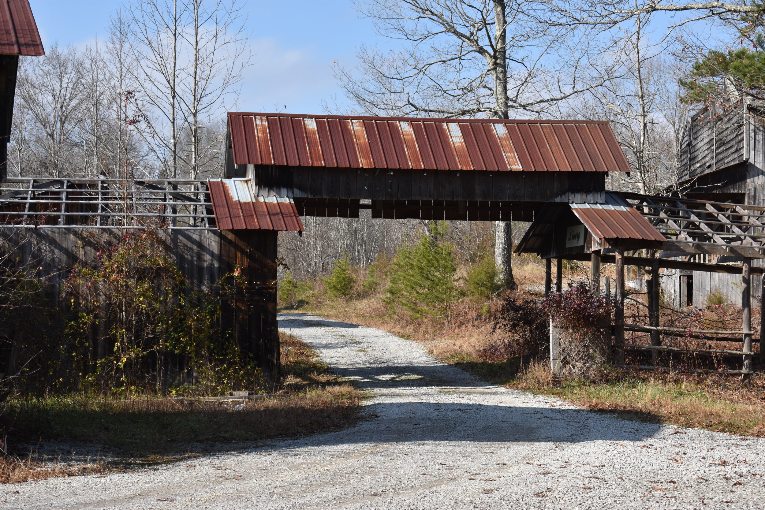
Suddenly, the trees cleared, and we saw a metal tower owned by the FCC and beside it, a dilapidated wooden pavilion. We hadn’t noticed that we’d left state park land and thought it was perhaps another shelter in disrepair. Then, we came upon what I can only properly describe as a ghost town. Husks of crumbling buildings, brambles growing over everything, all from what felt like a bygone era. (At this point, my thoughts were 100% on the abandoned theme park from Spirited Away, and I was praying the whole time that spirits weren’t about to turn me into a pig. If you know, you know.)
It was strange what parts of the town survived, the signs that looked as if they’d been hung yesterday, the balcony that still supported Ryan (yes, I told him not to climb up there). Some of the wooden floorboards had rotted, all the windows were broken out, one of the roofs had collapsed, and some of the buildings had burned down completely, leaving only charred wooden spikes in their place. It was clear that teenagers used the area, walls spray-painted with their names, and all the electronic parts had been stripped from electrical boxes. Trash was everywhere, one room piled high with mail from 2006 and 2010, dog food, and microwavable meals. The place felt mysterious—had someone been living there as late as 2010? There was no evidence of electricity or running water, and half the place seemed to have been burned down. Had the fire been the cause of the town’s closure?
When we finally got service, we did our best to research what we’d found. The town was called Six Gun City, an Old West theme park that was operating in the 70s up until roughly the early 90s. Tombstone Junction, another Old West amusement park nearby, was connected to Six Gun City via train. There isn’t much information available about the Six Gun City theme park (though I’d like to get my hands on some newspaper archives in the library!) or why it closed. The most I could find was on Tombstone Junction, which suffered four fires, the last of which shut its doors for good in 1991. The railroad was stripped and the ties sold, and I have only anecdotal evidence for Six Gun City’s closure around the same time: my dad says he remembers going in the late 80s, then trying to go again and it being closed.
Now, I don’t condone doing what we did. Technically, Six Gun City’s remains are on private property (though they could really use some signs to tell people this), and it’s a hazardous area, what with all the glass, caved-in roofs, and rotted floorboards. But it did make for one wild adventure to stumble upon this strange place frozen in time, overgrown roads and disintegrating shops holding the memories of a destination bustling with visitors just 40 years before.


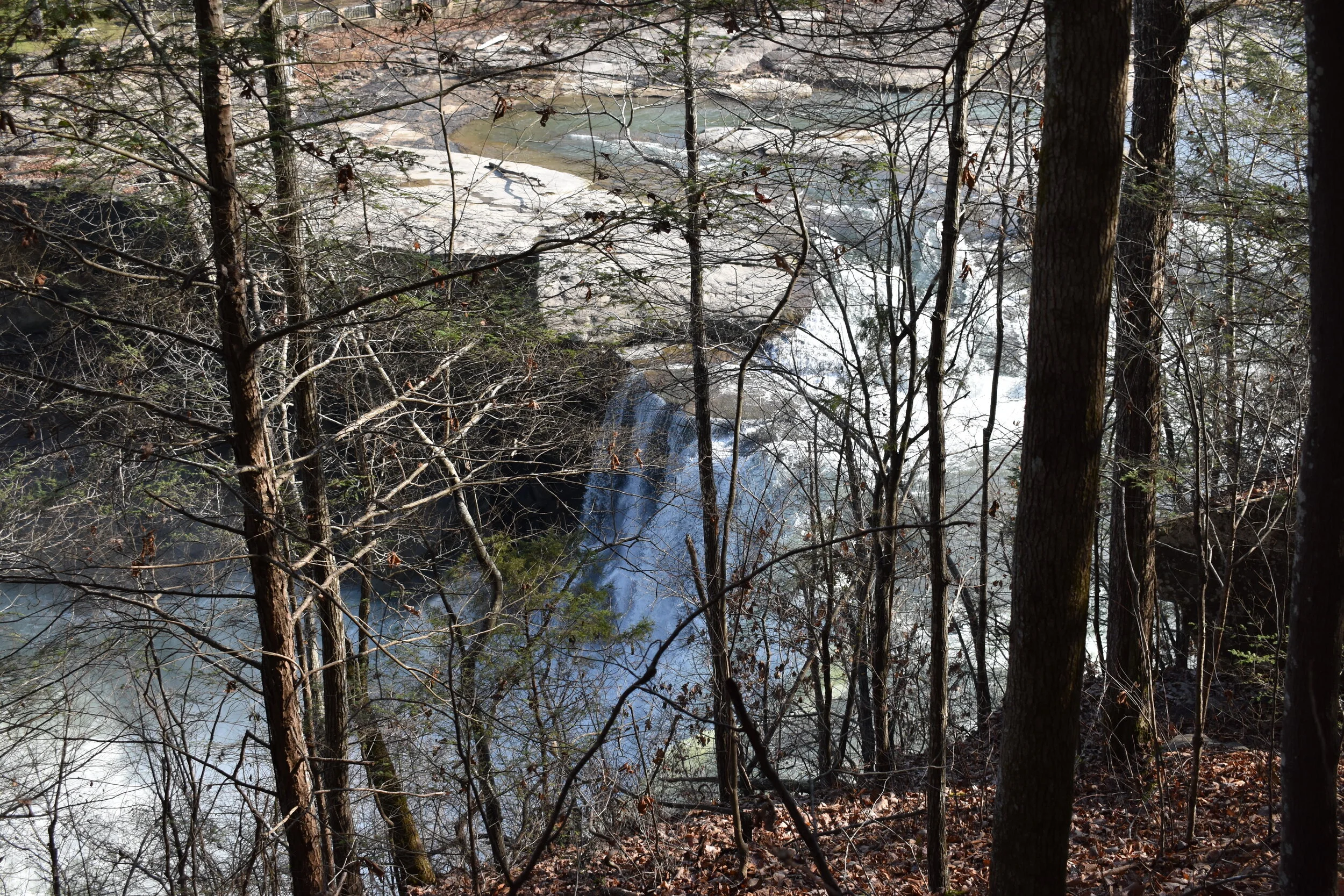
After recovering from our spooky exploration, we returned to the actual trail, and eventually, I got what I was promised: a magnificent view of Cumberland Falls.
The falls, known by some as the “Niagara of the South,” thunder down 68 feet, their width what makes them so breathtaking, at 125 feet. The mist created a beautiful rainbow in the winter sun, but it’s a different phenomenon that makes Cumberland Falls famous. It is one of only two places on earth where you can regularly see a moonbow (the only other being Victoria Falls on the Zambia-Zimbabwe border in Africa). Niagara Falls once too had a regular moonbow, but light pollution means it can no longer be seen.
A moonbow, also known as a white rainbow, is formed when the spray or mist from the waterfall refracts moonlight and creates a rainbow during the full moon period. The reason Cumberland Falls has the ideal conditions for this phenomenon is because of its steep gorge walls, up to 400 feet deep at some points, that prevent the mist from dissipating, and how wide the gorge is, which allows the moonlight to reach the mist. To the naked eye, the moonbow will look like a faint white arch, but with a camera and long exposure, a vibrant rainbow will appear from the dark.


The trail leads straight down to the riverbank, where you can climb up these massive boulders to get an even better view of the falls and the river.


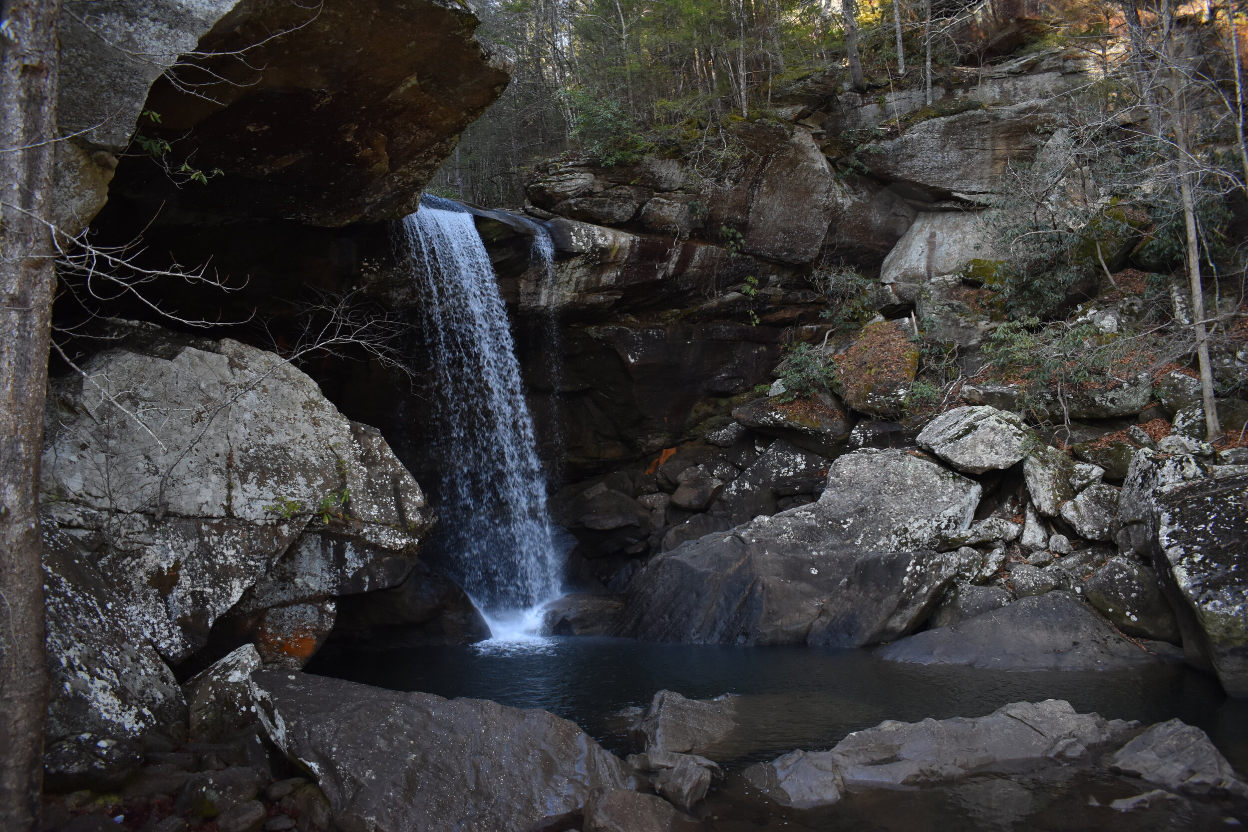
Shortly after, you reach Eagle Falls, which tumbles a stunning 44 feet into a rocky pool. This is probably my new favorite waterfall in Kentucky, the falls area enclosed by forest and lichen-covered boulders, the rush of water reverberating on the rock. And as a bonus, there was even a cave you could maneuver across the stream to see.


As a beautiful end to the hike, the trail led us along a stream, where the sun filtered perfectly through the trees, lighting up the water with golden filigree.


I’m already trying to plan my next trip back to Cumberland Falls to see the moonbow (I can’t believe I’ve lived in Kentucky my whole life and never seen it!) and explore more of the hiking in the area.
If you liked this post, don’t forget to hit the heart button below. Thanks for reading!