
Blooming Rhododendron on the Rock Bridge Trail (Red River Gorge, Kentucky)
My all-time favorite hiking spot is Red River Gorge back home in Kentucky. There’s a wide variety of trails and sights—from crazy rock formations, to waterfalls, to wading across creeks, to swimming holes. It’s the perfect place to go on a sunny weekend: enjoy the hour drive through vibrant green hills, get your hiking fix, then stop for a couple slices of pizza at Miguel’s afterwards.
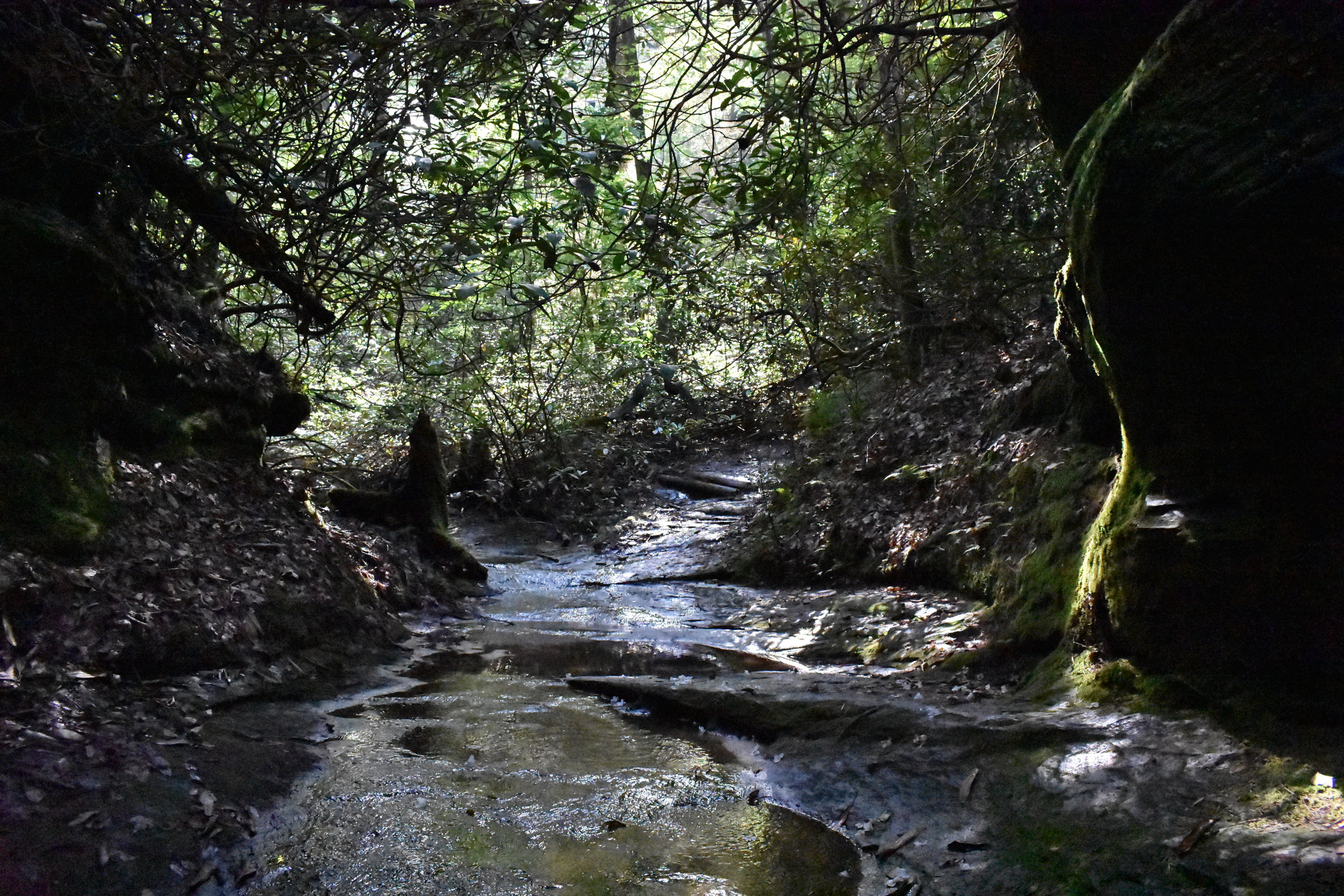
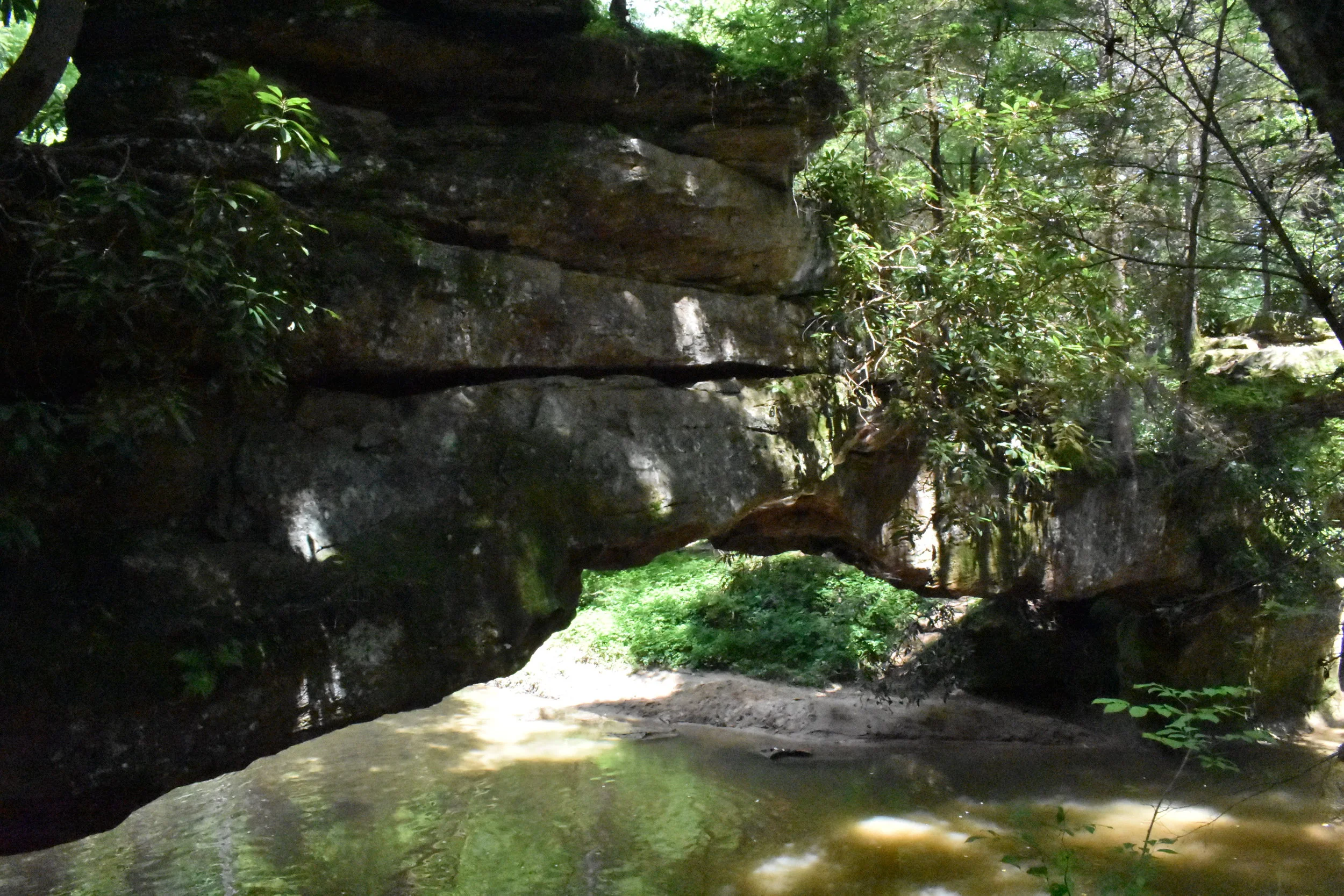
Last year, my (soon to be) in-laws bought me a book of all the hiking trails in the Gorge, so Ryan and I have been trying to mark them off our list while I’m back in Kentucky for the summer. Rock Bridge is a fairly easy 1.4-mile loop that leads to a natural rock bridge (get its name now?) and a fairly large waterfall. It is the only rock bridge in the Gorge that actually spans running water, as it stretches over Swift Camp Creek. Rock Bridge Arch is what is known as a waterfall arch, where a waterfall cut through less-resistant rock, leaving the arch behind. Rock Bridge is also unique because it is composed of limestone rather than sandstone like most of the arches in the Gorge.


Ryan and I were lucky to plan this trip at the perfect time to see all the rhododendron blooming, littering the trail with white petals. This variety of rhododendron tends to bloom in late June and the blooms last about three weeks, so we caught the tail-end of their blooming period.


Creation Falls lies along Rock Bridge Fork, which later joins Swift Camp Creek. There’s a sandy beach surrounding the falls and the stream, making it perfect for a swimming break.


At the end of our hike, this little guy posed for a few photos. Red salamanders are typically found in or near springs and cool clear brooks, plus the surrounding woodlands or swampy areas. They’re 4-7 inches long and mostly eat earthworms.


After finishing the Rock Bridge Trail, we thought we still had some steam left in us, so we also attempted to find Turtle Back Arch. The trail for Turtle Back does connect to Rock Bridge, so that wasn’t too difficult to find; however, we really ignored that this trail requires, according to our hiking guide, “route-finding skills, some bushwhacking, and a map and compass.” It didn’t help that we had to follow the directions backwards because we were starting from a different trailhead, but we managed to find the secluded, unnamed waterfall it mentions, the sandstone canyon of Hell’s Kitchen, but then got lost once it asked us to climb a 15-foot rock face. We were easily able to get back to the trail and head home, but felt a little defeated by our first off-trail excursion.
And of course, after our hike and slight misadventures, we were ready for some Miguel’s, so we popped back to Exit 33 and partook in that most sacred tradition of Gorge hikes.
Thanks for reading! If you enjoyed this post, don’t forget to hit the heart button below!